Spatial Data Science across Languages
2024
Thank you for being here
Faculty of Science
Map and Data Centre
Program committee
Yomna and Edzer
Danka and the team
Practical info
- Toliets
- Breaks
- Dinner
Hybrid setting
- Zoom
- Discord
- Notes
Ask questions on Discord, where we can have a persistent discussion, rather than on Zoom.
Scope, Goals, and Outcomes
Bridge the language barriers
Bring the communities together
Discuss the differences and commonalities
Find ways to discuss, cooperate,
and synchronise the efforts
Primarily developer-oriented audience
In-person discussion as the main goal
Recommendations
Connections
Cross-pollination
Expectations
- What do you expect from this workshop?
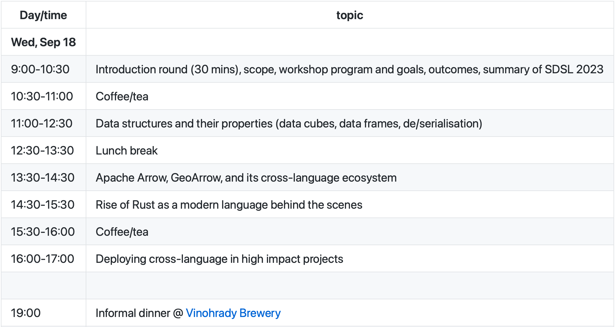
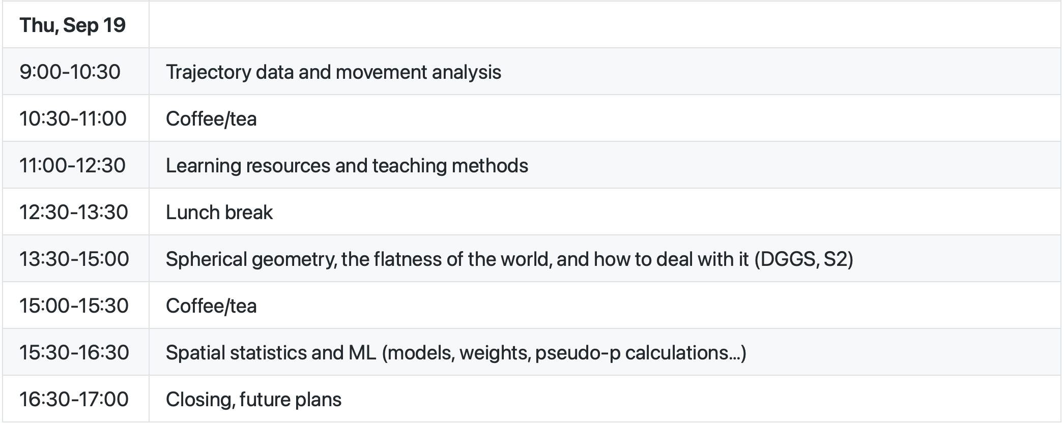
Program
- Each session to be kickstarted by a short talk.
Looking back at 2023
Personal reflections
Different maturity of ecosystems
Omnipresence of Arrow
Freedom vs. security mindset
Working paper

Point vs block support


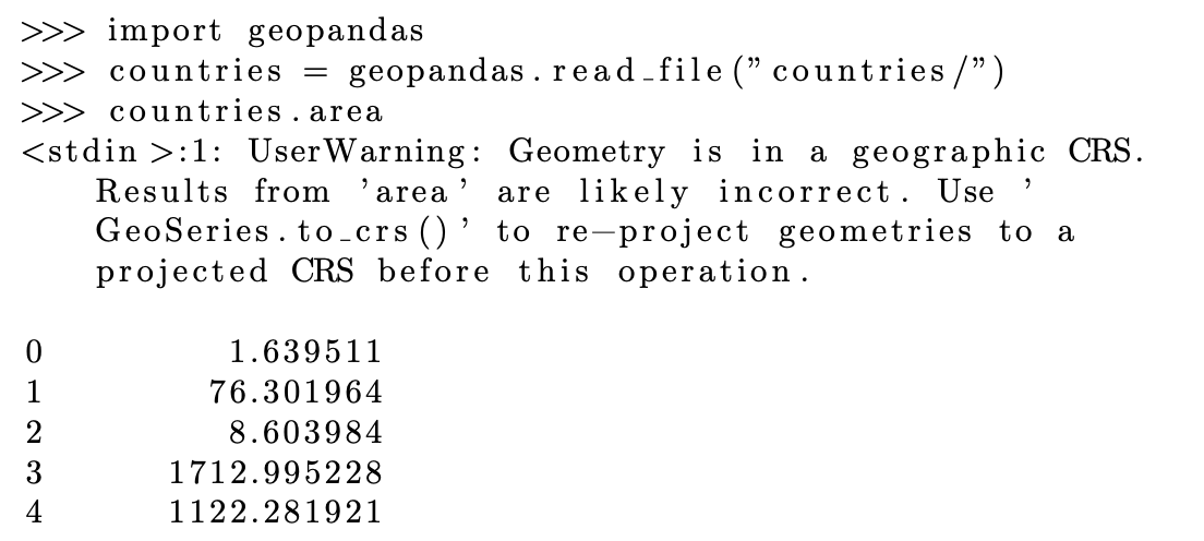
Geodetic coordinates
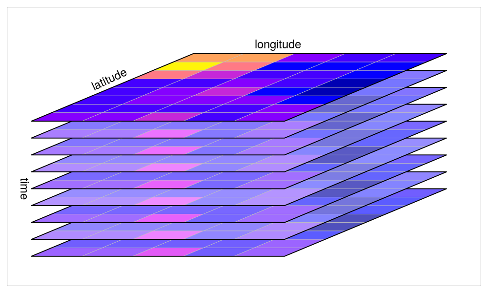
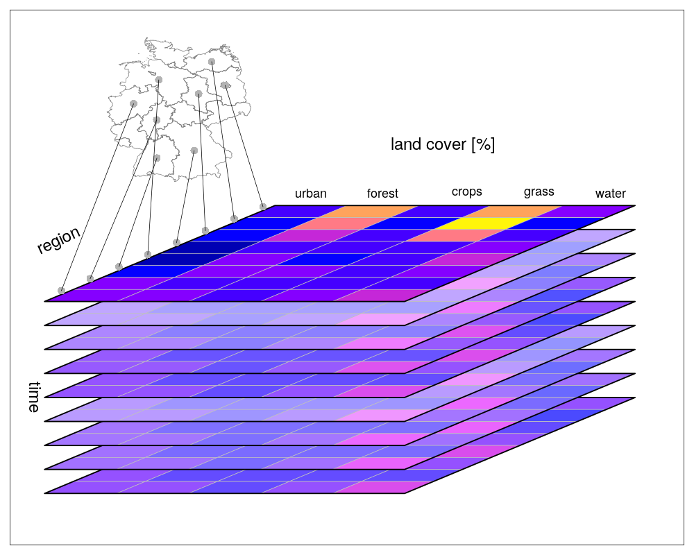
Data cubes
File formats, data connectivity, and in-memory representation
- GeoParquet
- GeoArrow
- Zarr, GeoTIFF
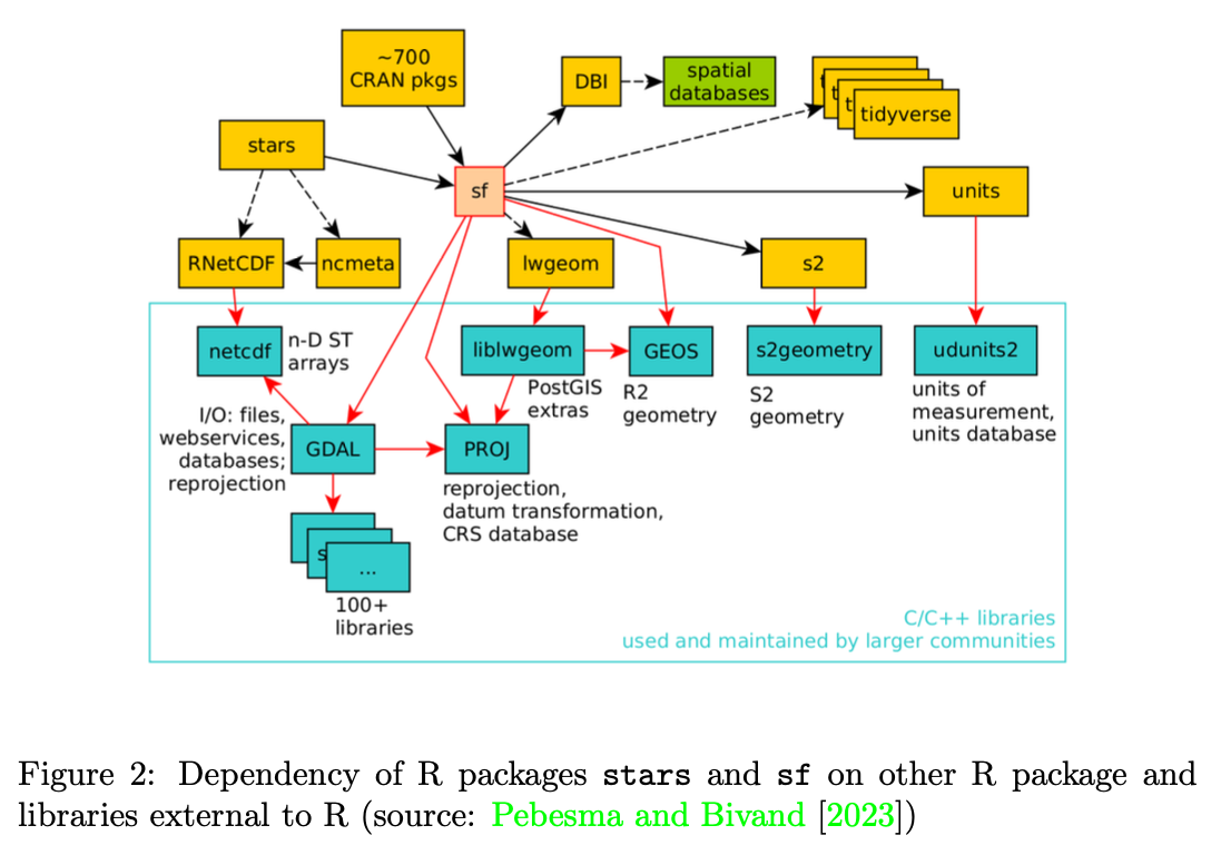
Inter-package dependencies and shared upstream libraries
Recommendations
Open Standards
It is encouraging to see that involvement in the development of open geospatial is no longer restricted to members of the Open Geospatial Consortium (OGC), and takes place in issues of public OGC GitHub repositories (for instance for GeoZarr and GeoParquet), or even completely outside OGC communication channels (e.g. STAC, GDAL, and openEO).
It would be convenient to have routines to verify polygons form a coverage (i.e. are not overlapping), or to create non-overlapping polygons from overlap- ping ones polygons, in a way that all spatial data science languages can profit from.
Wider adoption of GeoParquet as a more efficient file format for whole-file read/write and wider adoption of GeoAr- row as a common metadata standard and memory model may help address […] challenges.
Field domains
Splitting spatially extensive block support variables to point geometries should at all times be avoided.
[…] split and merge policies follow from a variable being spatially extensive or intensive, and hence one of them is obsolete.
A less ambiguous approach would be to have a single field domain called
is_spatially_extensivewith a boolean value.
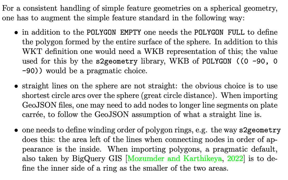
Geodetic coordinates, spherical geometry
#sdsl2024